Does phone GPS work without cell service?
Yes. GPS is a receive-only satellite system built into every modern phone; it works with zero bars, in airplane mode, anywhere with sky. What dies without service is the map imagery, and downloading offline maps in advance fixes that completely.
This is the most useful correction in modern navigation, because most people believe the opposite. The blue dot doesn’t come from cell towers; it comes from satellites your phone hears for free. What cell service normally provides is the map tiles underneath the dot, streamed on demand. Lose coverage without offline maps and you get the lonely dot on a blank grid; lose it with offline maps and you have a full navigation instrument showing position, trails, terrain, and track.
So the whole chapter compresses to one commandment and its details: download before you go. The details (which apps, what to download, how to keep the phone alive, and what watches add) follow.
Setting up offline maps
Install one dedicated mapping app, download your regions at topographic detail while on home Wi-Fi, and refresh them seasonally. Twenty minutes of setup converts the phone into the best map you’ve ever carried.
The app landscape shifts yearly, so buy the categories rather than the names: outdoor mapping apps (subscription services with topo layers, trail databases, track recording, and dependable offline downloads) are the hiker’s tool; general map apps (the ones already on your phone) offer offline areas that cover road travel well and trails poorly; open-data apps built on community map data offer remarkable free worldwide detail. A reasonable adult setup: one outdoor app with your home region and trip areas downloaded, plus offline areas in the general app for road corridors you drive.
Download craft: download the topo layer as well as the roads; size regions generously (storage is cheap, regret isn’t); check the download actually works in airplane mode before trusting it (a two-minute test at home); and refresh after app updates, which occasionally orphan old downloads. Add your kit note: trailhead, vehicle position, and camp get pinned the moment you arrive anywhere; future-you navigates to pins.
Field doctrine for phone navigation
Airplane mode with GPS on is the field configuration: full navigation, small battery cost. Check position at decisions, not continuously, and record a track only when you’ll genuinely use it.
Chapter 10 set the power law (radios are the appetite; airplane mode ends the tower hunt) and navigation inherits it. GPS reception itself sips modestly; the screen and cell radio are the gluttons. Practical rhythm: phone dark in the pocket, woken at junctions and doubts, position confirmed against the world (“the map says the stream bends left here; does it?”), then dark again. Track recording (a breadcrumb trail you can walk back out on) is genuinely valuable off-trail and in snow, and costs steady battery; turn it on for the fog, not the whole trip.
Cold doctrine rides along: lithium sags below freezing, so the phone lives in an inside pocket, and a “dead” cold phone often revives warmed against your body. The Chapter 10 bank covers the rest. And the paper-and-needle layer from Chapter 18 stays in the pack, not because the phone is bad, but because its failure modes all arrive together on the worst day.
GPS watches and dedicated units
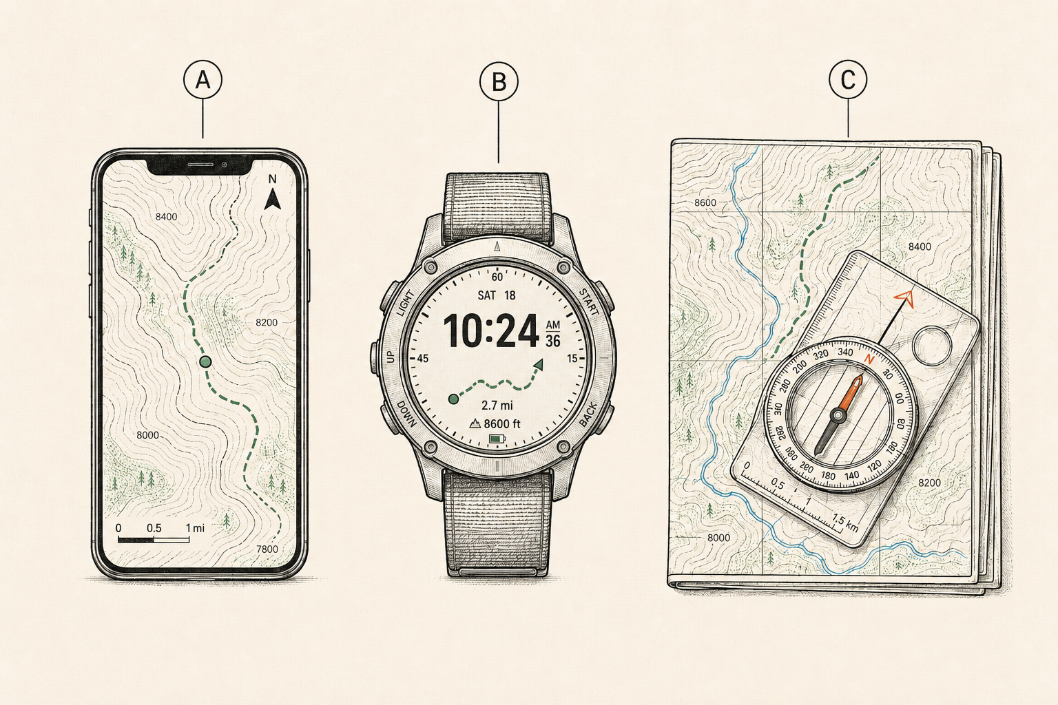
A GPS watch adds a glanceable position layer that survives your phone’s death; a dedicated handheld GPS adds button-driven ruggedness for gloved, wet, weeks-long use. Both are refinements, not requirements.
The watch case is convenience compounding into safety: back-to-start routing, breadcrumbs, and altitude on your wrist, with its own battery, means a dead phone no longer means blind. Multi-day battery modes on outdoor watches genuinely cover weekend trips. The honest limits: postage-stamp maps (fine for following a line, poor for planning), and cost.
Dedicated handhelds, once the default, now serve specific users: glove-and-storm operators, months-long expeditions (AA batteries swap forever, per Chapter 9‘s standardization), and anyone who wants navigation fully divorced from the phone’s battery politics. For most readers, phone-plus-paper is the doctrine and a watch is the nice upgrade; the handheld is a specialist’s tool that this book respects and doesn’t require.
When the blue dot lies
GPS positions degrade in canyons, dense canopy, and cities, and map data itself contains errors: trails that moved, roads that never existed. Navigate by agreement between instrument and world, and believe the world when they argue.
The failure modes are worth naming so they don’t surprise you. Multipath (signals bouncing off canyon walls and buildings) can drag the dot dozens of yards; canopy slows and degrades fixes; a phone that’s been off may need minutes of sky to settle. Map-data errors are the sneakier class: community-sourced trails include some that are game paths, closed routes, or wishes; even official data ages. The symptom is always the same: the map says one thing, the ground says another.
The rule that keeps digital navigators honest is the old pilot’s rule: cross-check. Position fixes get sanity-checked against visible terrain (Chapter 18‘s contour literacy is the decoder); a “shortcut trail” that the ground doesn’t confirm doesn’t exist; and when instrument and world disagree, the world is right and the gadget gets a skeptical squint. Navigation trouble rarely starts as being lost; it starts as trusting one source too long.
Sharing position and the rescue seam
Modern phones and messengers can share live or last-known position with your home contact, which quietly merges navigation with Chapter 17‘s rescue layer. Set it up before trips; it turns “somewhere on the mountain” into a dot for searchers.
The mechanics vary by platform (phone location sharing to a family member, a messenger’s tracking page, a watch’s live-track), but the doctrine is uniform: your trip-plan person (Chapter 17) gets access, knows what silent-past-the-deadline means, and knows the last-known-position matters even hours old, because searches start from last-known and grow. Screenshot-texting a map pin from the trailhead is the low-tech version and better than nothing by miles.
The seam to respect: sharing depends on coverage (it’s the cell radio talking), so its last update marks where coverage ended, not where you are. That’s still gold to a search planner. The satellite devices from Chapter 17 close the gap for the truly remote.
Vehicle and urban digital navigation
The vehicle’s navigation kit is offline road maps plus a paper road atlas, because disasters take cell networks with them. Urban emergencies are navigation problems too: evacuation routes, closed bridges, and family rally points all live on maps.
Regional disasters (Chapter 34‘s hurricanes, earthquakes, wildfires) reliably produce the same navigation scene: cell networks congested or down, familiar routes closed, and thousands of people discovering their entire navigation life was streamed. The fixes are cheap: offline-download the road corridors you’d evacuate along, keep the paper atlas in the trunk (a dollar-store atlas navigates a continent without electricity), and pre-mark the family plan’s rally points and out-of-area contact routes on both.
Urban craft note: transit outages turn cities into walking problems, and walking-scale offline maps of your own city (the same download habit, aimed at home) turn a ten-mile transit failure into a route instead of an odyssey. The get-home bag of Chapter 33 assumes exactly this.
Building the habit
Digital navigation is a maintenance habit wearing a technology costume: download regions, refresh seasonally, test in airplane mode, pin the trailhead, share the plan. Write it into the kit calendar and it stays real.
The failure pattern this chapter exists to prevent is entirely a calendar failure: the app was set up two years ago, the region download aged out, the subscription lapsed, and the discovery happens at the trailhead with one bar. So the checklist joins Chapter 41‘s audits: offline regions verified (airplane-mode test), subscriptions current, home and trip regions refreshed, sharing permissions still working, and the paper backups still where paper lives.
Then practice, because the tool you fumble is the tool you don’t have: one deliberate navigation session per season using only the phone (then only paper, per Chapter 40), a track recorded and followed back out, a pin navigation to a set point. Twenty minutes each. The dot is only as smart as its operator.
Pack This Chapter
- GPS works with zero bars; map tiles don’t. Download offline topo regions on home Wi-Fi and test them in airplane mode.
- Field config: airplane mode + GPS. Check at decisions, track in fog and snow, phone warm and dark between.
- Watches keep a glanceable layer alive past phone death; handhelds are for gloves, storms, and expeditions.
- Cross-check the dot against the world; the world wins arguments. Community trail data contains fiction.
- Share position with your trip-plan person; keep road corridors offline and an atlas in the trunk. Refresh it all on the kit calendar.
Where Kits Fail
- Maps assumed, not downloaded. The blank grid under a lonely blue dot, discovered at the trailhead. Download is the whole religion.
- The two-year-old setup. Aged-out regions, lapsed subscription, orphaned downloads. Digital gear rots on calendars, not shelves.
- Track recording as a lifestyle. All-day breadcrumbs drain the battery that the fog will want. Record when return-finding matters.
- Gadget faith in a canyon. The dot said cross here; the river disagreed. Instruments propose, terrain disposes.
Frequently asked
Does GPS on a phone work without cell service?
Yes, completely. GPS is receive-only satellite positioning independent of cell towers, and it works in airplane mode. What you lose without service is the streamed map imagery, which offline downloads replace. Blue dot plus downloaded topo equals full navigation with zero bars.
What’s the best offline map app?
Buy the category, not the name: a dedicated outdoor mapping app with topographic layers, dependable offline downloads, and track recording, plus offline areas in your everyday map app for roads. Test any choice in airplane mode at home. The specific market leaders shift; the requirements above don’t.
Are GPS watches worth it for hiking?
As a resilience layer, yes: position, breadcrumbs, and back-to-start on your wrist with its own battery means a dead phone no longer blinds you. As a sole navigator, no: screens are too small for planning. Pair one with the phone-plus-paper doctrine rather than replacing it.
How much battery does GPS navigation use?
Less than people fear when configured right. Airplane mode kills the tower-hunting that actually drains phones; GPS reception itself is modest, and the screen is the remaining cost. Position checks at decision points rather than continuous navigation stretches a phone across days, with Chapter 10’s bank behind it.